Lot 67
Thomas Jeffrey (1719-1771)
Lot 67 Details
Thomas Jeffrey (1719-1771)
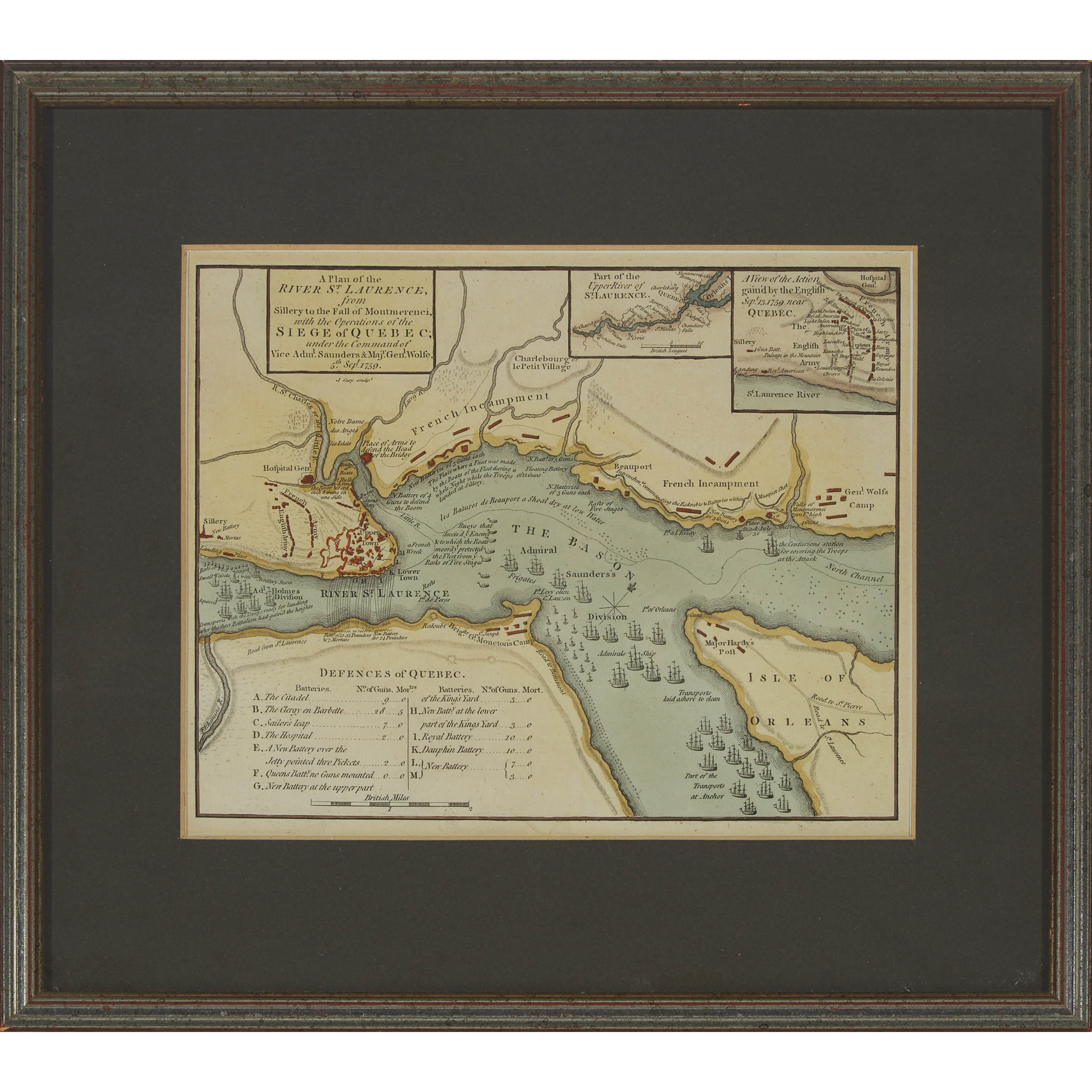
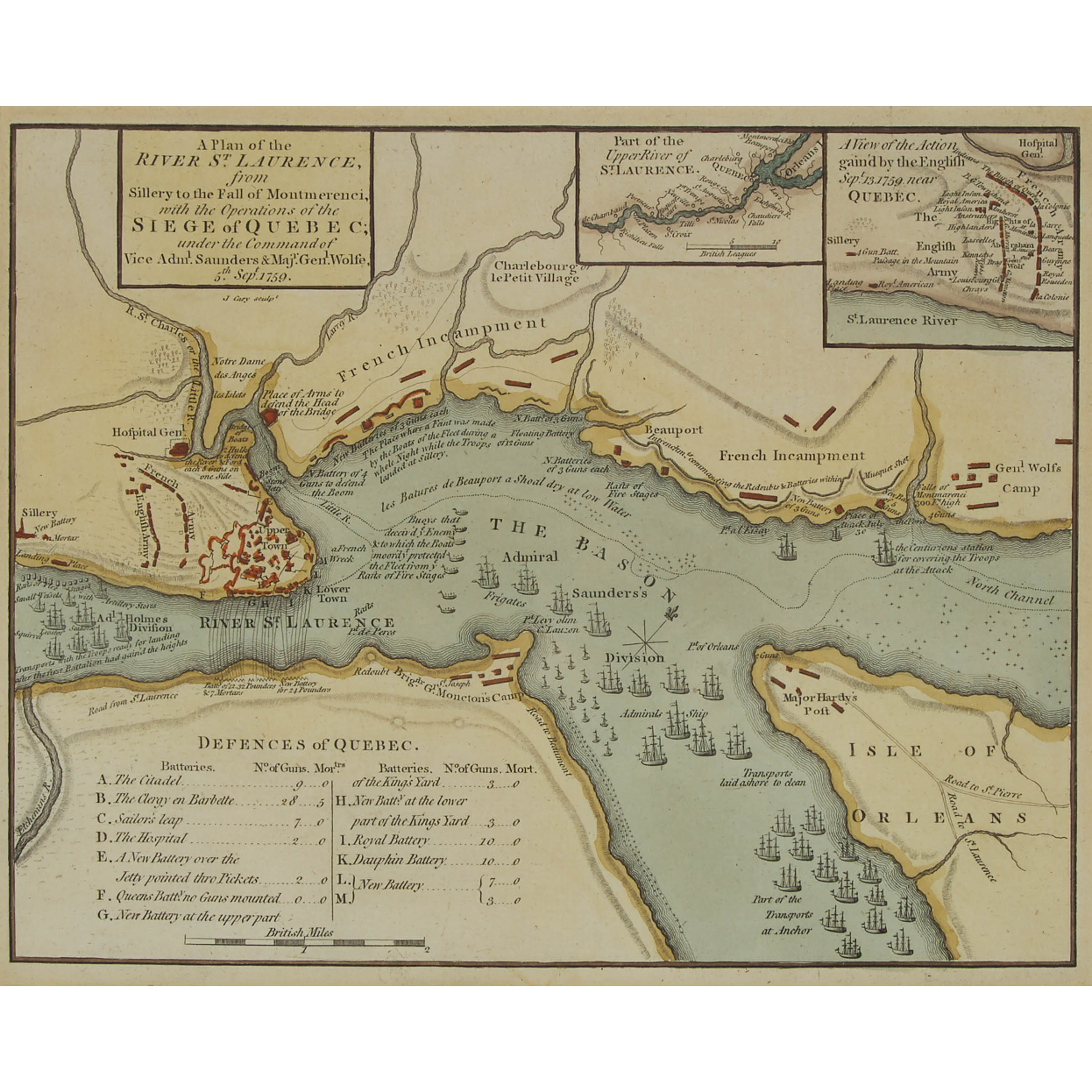
A PLAN OF THE RIVER ST. LAURENCE FROM SILLERY TO THE FALL OF MONTMORENCI, WITH THE OPERATIONS OF THE SIEGE OF QUEBEC UNDER THE COMMAND OF VICE-ADML. SAUNDERS & MAJR GENL. WOLFE, 5TH SEPT. 1759
hand coloured engraved map of Quebec City and its environs, with insets of the battle of the Plains of Abraham and 'Part of the Upper River of St. Laurence', framed
7.75 x 9.5 in — 19.7 x 24.1 cm; 12.75 x 14.25 in — 32.4 x 36.2 cm
One of the first maps of the area to be printed in London following the news of the British victory on the Plains of Abraham and widely considered to be the most authoritative contemporary pictorial depiction of the series of events leading up to the battle, and the most important printed map in Canadian history.
Estimate $200-$300